Our Photo Gallery
Camera: Hasselblad 500C/M Lens: Zeiss Planar T* 2.8/80mm Film: Zeiss Planar T* 2.8/80mm Date: 21.09.1990
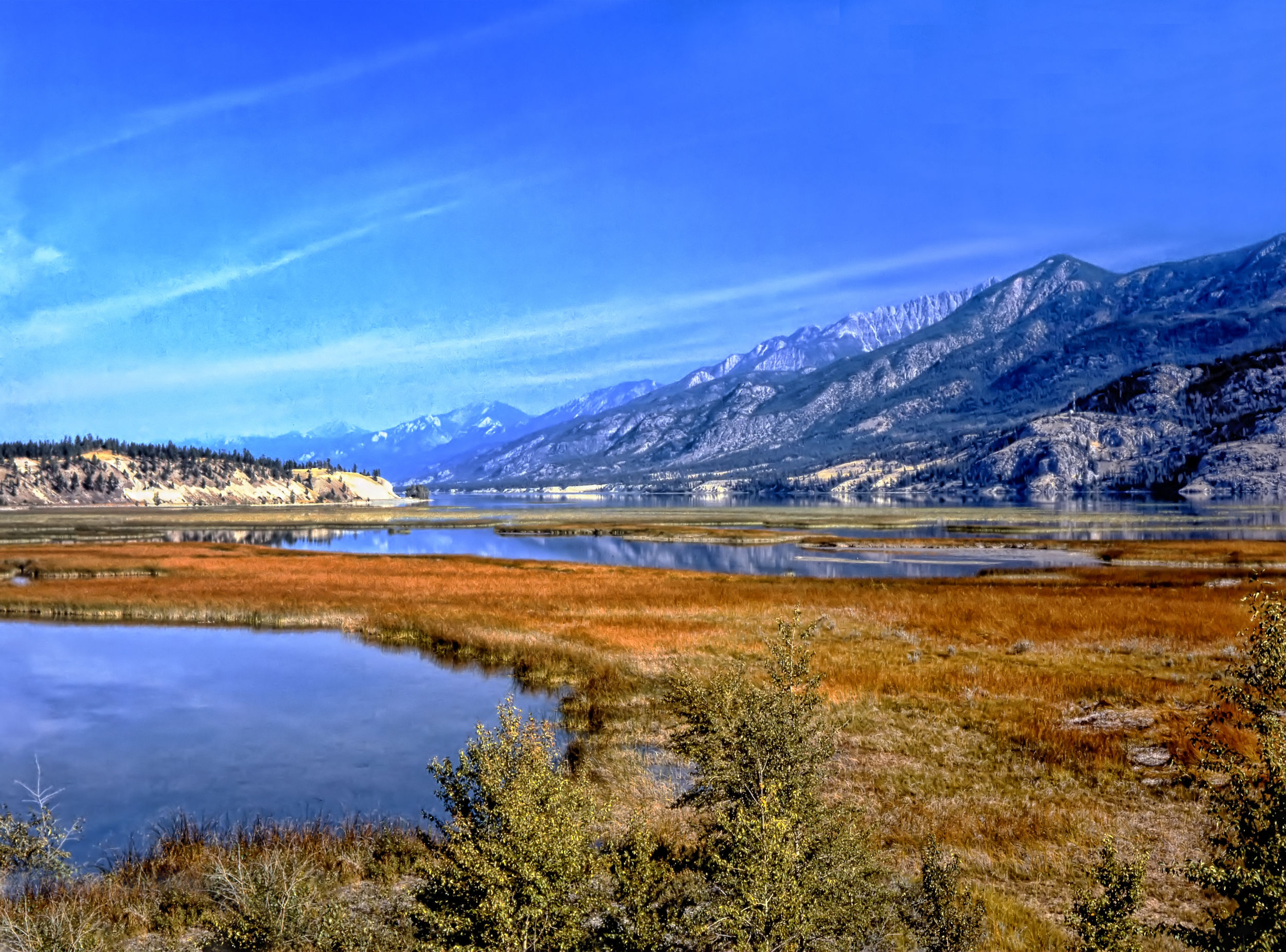
Source of the mighty Columbia River, Canal Flats, East Kootenays, BC
Humans have inhabited the Columbia's watershed for more than 15,000 years, with a sedentary lifestyle based mainly on salmon. The Shuswap people (Secwepemc in their own language) consider the whole of the upper Columbia east to the Rockies as part of their territory, while the Sinixt (or Lakes People) and the Ktunaxa (or Kootenay) lived on the lower stretch of the Canadian portion of the river. South of the border, the Colville, Spokane, Coeur d'Alene, Yakama, Nez Perce, Cayuse, Palus, Umatilla, Cowlitz, and the Confederated Tribes of Warm Springs live along the US stretch.
After flowing northwest from its source in the Columbia Lakes for about 300km, the river takes a sudden 180° turn ("The Big Bend") and flows south through Revelstoke Lake and the Arrow Lakes, passes the cities of Castlegar and Trail, before entering the United States just south of the confluence with the Pend Oreille River. Today, the river is heavily dammed for irrigation and power generation purposes. (Ironically, the only stretch of the river that is completely free-flowing within the US, unimpeded by dams, is within the Hanford Nuclear Reservation, a decommissioned and extremely polluted nuclear production complex.)